Historical JuraMap aerial photos
The raster JuraMap has a layer (called Photos) that displays aerial photos of Switzerland taken in 1933.
Raster layer procedure
Swisstopo has recently made aerial photos of Switzerland taken in 1933 available by downloading using the LUBIS Viewer so the procedure described below is no longer required. Instead, using QGIS a downloaded geotif image (downloaded, for example, by clicking the "33" square near Baragne) is reprojected to EPSG3857 and EPSG3857 is assigned to the layer which is then exported as an image.
The exported image is opened in Photoshop that has Avenza's Geographic Imager extension installed to allow one to edit geotiff files (edited files are saved as "Big TIFF" files). For our fairly old Photoshop (CS5, Version 12.0) an old Imager version (v4.5.1) worked but one needed to ask Avenza for a licence for an old version. The exported image is trimed to remove edge artifacts and saved (as a copy with transparency preserved and no compression). The Switch2OSM mapnik.xml file for rendering a raster layer of aerial photos simply has a succession of <Style> statements of the form:
<Style name="raster">
<Rule>
<RasterSymbolizer/>
</Rule>
</Style>
<Layer name="aerialphotos" status="on" srs="+proj=merc +a=6378137 +b=6378137 +lat_ts=0.0 +lon_0=0.0 +x_0=0.0 +y_0=0.0 +k=1.0 +units=m +nadgrids=@null +wktext +no_defs +over">
<StyleName>raster</StyleName>
<Datasource>
<Parameter name="format">tiff</Parameter>
<Parameter name="type">gdal</Parameter>
<Parameter name="file">/home/ertert/osm/aerial/baragne.tif</Parameter>
</Datasource>
</Layer>
Original procedure
Virtually all of the southwestern corner of Switzerland's Jura Mountains was photographed from the air in 1933. Many of the aerial photographs are available for viewing at full resolution using Swisstopo's LUBIS viewer. Each image is accompanied by a data sheet giving the flight date, the type of image and an image preview. However, an orthophoto mosaic produced using the aerial images of 1933 has not been produced (the SWISSIMAGE orthophoto mosaic produced using aerial images starts in 1984).
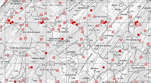
To establish the development of the Jura Mountain's road network and other features such as forest boundaries, map tiles are being created from images downloaded from the LUBIS Viewer. As an example, the LUBIS Viewer displays a map with the positions of aerial photos maked with the year ("33" for 1933) of the photo.
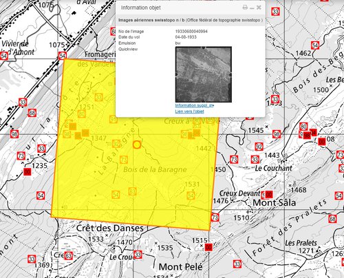
Clicking on a marker brings up a panel that displays the photo.
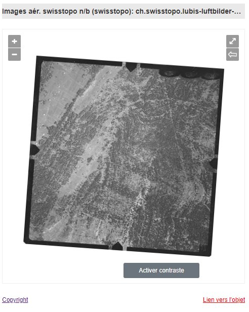
Clicking the rotation control rotates the photo to the vertical. The photo can then be zoomed to full resolution and the part displayed saved as a .png.
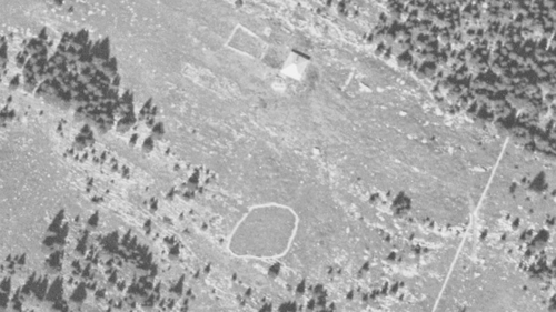
By carefully downloading a series of adjacant images one can use an image editor such as Photoshop to stich together a mosaic that covers the entire photo. Attempts to automatically stitch together the imges was unsuccessful.
A stitched photo of the highest resolution is about 1.4 Gb in size. The trimed photo is rotated back to its original orientation and loaded into QGIS. The QGIS georeferencer is then used to georeference the photo. The georeferenced photo's no data value is set to nothing by running the QGIS Translate (Convert Format) routine and tiles with a transparent background are created by runing QGIS's gdal2tiles with the transparency value set to 255.
As an example, tiles for an area close to the Jura Mountain's Mont Péle are available on the JuraMap's side-by-side map and on the main map.
Updated 21 August 2024